
New release of MapStore with vector editing support
Dear Reader,
we are pleased to announce a new release of MapStore, our flagship Open Source webgis product, which we have called 2017.04.00. The full list of changes for this release can be found here, but the latest most interesting additions are the following.
- Support for vector layer editing (via WFS-T)
- Direct access to the data grid from the TOC
- New data grid with a better look & feel
- Advanced search moved from the TOC into a separate panel, accessible directly from the feature grid
- Legacy maps (from MapStore version 1) are identified. The author that access to a legacy map will be guided to update.
- Localization in Spanish
Support for vector layer editing
This release gives you the opportunity do edit your vector data. If you integrated the authentication system with GeoServer, you will be able to login as administrator and edit your vector data’s attributes and Geometries.
-

- Edit Polygons, …

-
- … edit Attributes (with type checking)…

-
- …and save to see the results

-
- Edit lines…

-
- …and points

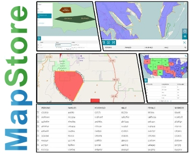
Improved access to the vector data with a new data grid.
Now you can browse data for vector layer in a more intuitive way. You can open the data grid directly from the TOC, without using the query panel. The new data grid has a toolbar on top to access to the main functionalities (search, editing, download…), where available. Advanced search is still accessible from the feature grid.
-
- Access to the data grid from the TOC

-
- Open the advanced search panel

-
- Create the filter

-
- Browse the results

If you want to play with the improved feature grid we have loaded some data from Atlantis (yeah, we know where it is, just don’t spread the word…) in a MapStore simplified application that you can find here. Don’t worry if you mess the data, every night the original data will be restored!
-
- Feature Editor at work on Atlantis

-
- Editing a road

Guided update for legacy maps
The user will be notified when a map that was created with MapStore 1 needs to be updated, if he has the right permissions to do that. Clicking on Update button the update will be performed automatically.
-
- A privileged user will be notified if a map is not updated

-
- The update procedure is fully automated

Future Work
The work for the next releases will be focused on TOC & Catalog style review plus code hardening. Take a look on the Proposal or the interactive mockup (both still in progress) for an early preview.
If you are interested in learning about how we can help you achieving your goals with open source products like GeoServer, Mapstore, GeoNode and GeoNetwork through our Enterprise Support Services and GeoServer Deployment Warranty offerings, feel free to contact us!
The GeoSolutions team,
